/
Source Image
Loading...
English
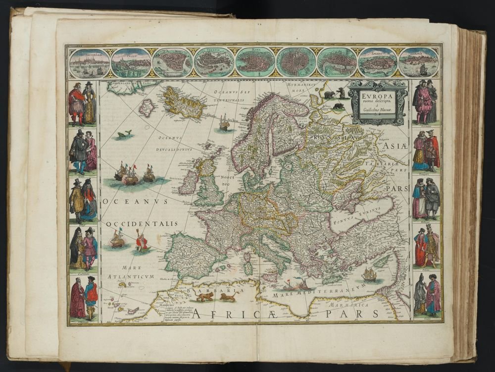
EUROPE
recently described by Guilielmus Blaeuw.
A detailed hand-colored engraved map of Europe titled "EVROPA recens descripta à Guilielmo Blaeuw." The map is framed by decorative borders. The top border features nine circular inset views of major European cities: Amsterdam, Prague, Constantinople, Venice, Rome, Paris (labeled Lutetia), London, Toledo, and Lisbon (labeled Olisipo). The side borders depict ten pairs of figures illustrating national costumes of the 17th century. The map itself covers Europe, Northern Africa, and Western Asia. The seas are adorned with sailing vessels and sea creatures. Northern regions such as Russia feature drawings of bears and a horse-drawn sled, while lions are depicted in the North African interior. A decorative cartouche in the top right contains the title. In the bottom left, an inset text box provides a geographical note in French regarding the sources of the Nile.
CITY VIEWS (Top Border)
AMSTERDAM
PRAGUE
CONSTANTINOPLE
VENICE
ROME
PARIS
LONDON
TOLEDO
LISBON
NATIONAL COSTUMES (Side Borders)
Left: English, French, Belgians, Castilians, Venetians.
Right: Germans, Hungarians, Bohemians, Poles, Greeks.
The opinion of Ptolemy and the ancient geographers, by which the sources of the Nile are situated in great lakes at the Mountains of the Moon, is no longer accepted. For by the voyages of the Portuguese, it is now known that they originate from a great lake named Zaire or Zembre in Upper Ethiopia.
Use ← → arrow keys to navigateSwipe left/right to navigate·Produced by SourceLibrary.org in Amsterdam, 2026